Mount Washington, February 2014


Mount Washington via the Lion Head Winter Route
It had been a little more than two months since my previous attempt on Mount Washington and, not surprisingly, not much had changed with the weather. Forecasts called for periods of snowfall, strong wind gusts (approaching 100 mph) and extremely cold temperatures (wind chills approaching -54 degrees F) over a three-day period. No one day looked better than the other, nor did any one time of day, so I decided to set foot on the Lion Head Winter Route right before dawn on February 25.
Mount Washington, nicknamed the “home of the world’s worst weather,” is notorious for its inclement weather, so the weather forecast was no surprise. As always on this peak in winter, I had to plan wisely and expect to use nearly everything I packed.

Cold
I started up the Tuckerman Ravine Trail before sunrise with headlamp shining and the air temperature pretty modest at about 10 degrees F. This early portion of the route was noticeably different than a few months earlier in December 2013.
Back in December, the first 2+ miles of hiking were over extremely icy terrain, as freezing rain had hit the area only days before. This time around, there was a nice snow crust to ascend up. Snowshoes weren’t necessary, as frequent travel on this portion of the trail had packed it down nicely, but microspikes did come in handy.

Lion Head Winter Route
After about 1.7 miles on the Tuckerman Ravine Trail, I hit the turnoff for the Lion Head Winter Route and promptly took my first break to grab some food and water, and to change from microspikes to crampons. Little did I know that it would be my last break until the summit. The temperature dropped considerably here, as northerly winds picked up and froze bare skin instantaneously.
With crampons on and ice axe out, I headed up the half-mile, 1,000 foot gain that was immediately ahead. This portion of the trail is probably the steepest and toughest climbing but went without incident. The first half of this section was packed nicely but I did have to break trail the second half, as snow drifts had accumulated in multiple areas.
Windy
I exited this steepest section of the route right at the tree line and promptly got blasted with wind gusts that only seemed to increase every five steps. The next half mile of the route passing through Lion Head is known as the most exposed area of the route and is said to often experience winds even higher than on the summit. I don’t know what the wind speed was or what the wind chill got down to, but I can say that this 45 minutes was the coldest and windiest I have ever experienced for a prolonged period on any peak, anywhere.

No rest for the weary
I simply could not stop; it was too cold, too windy. I alternated crouching steps into the wind with ducking behind large rocks until I finally reached the alpine garden and promptly continued west to reach the snowfield that leads to the final northward push to the summit. I broke trail up the snowfield to reach Split Rock, turned north and weaved through icy rocks and patches of snow the final 600 vertical feet to the summit.
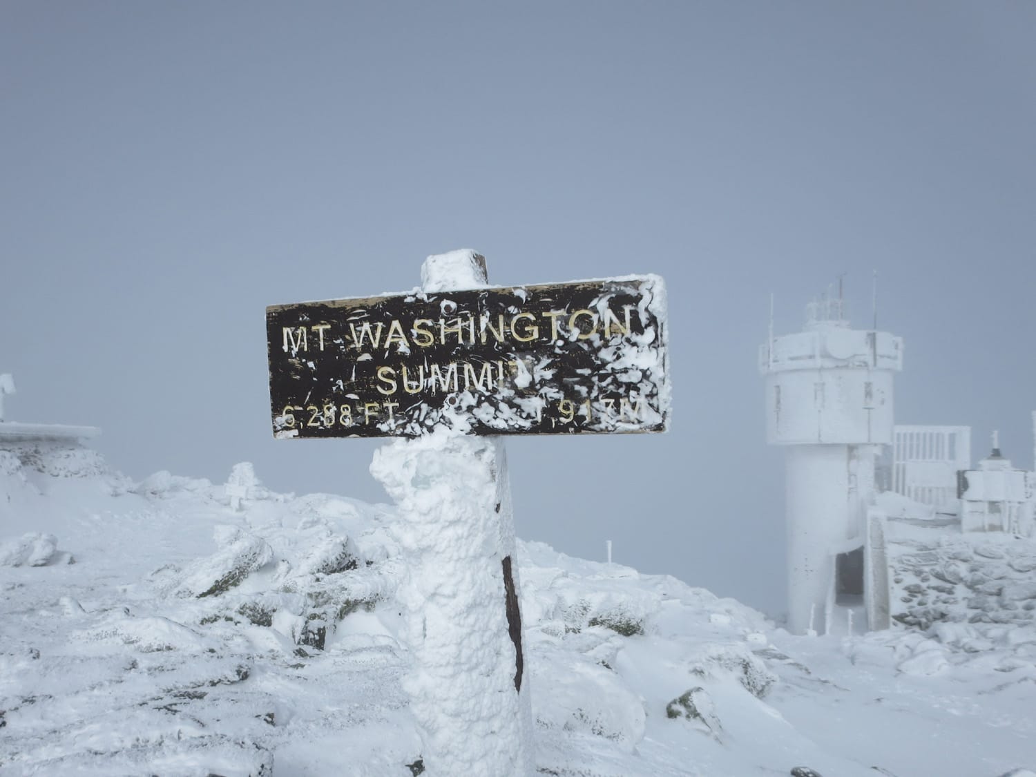
Summit
The wind did die down during the final 20 minutes to the summit but I continued on to the top without stopping. After downing a liter of water and a few frozen pieces of food, I snapped some summit shots as blue skies tried to push through the clouds. I had not seen a single person on the mountain all day.
Back down
There was a welcome break in the weather on the way down and I reached Lion Head quickly. Right at tree line I finally crossed paths with some other climbers, five up there and then four more down lower at the junction of the Tuckerman Ravine Trail and the Lion Head Winter Route. I kept my crampons on all the way back to the car and finally sat down for the drive back a little more than 6 hours after starting out.
More Mount Washington
- Trip Report: Mount Washington, March 2015
- Trip Report: Mount Washington, December 2013
- Route: Lion Head Winter Route, Mount Washington
GPX track
You should be able to see my GPX track loaded on the map above. Get in touch if you want to use this for your own climb.
Climb stats
Date of climb: February 25, 2014
Route: Lion Head Winter Route
Trail distance: 8 miles round trip
Elevation change: 4,250 ft
See also: Map & list of all U.S. State Highpoints
Photos from this trip