Humphreys Peak, June 2012

Hiking Humphreys Peak
Sometimes things are so obvious that they have a way of falling under the radar. I had heard great things about Flagstaff from many people over the years and the trailhead to Arizona’s highpoint – Humphreys Peak – sits a mere 14 miles north of Flagstaff. So, all things considered, a trip to the Southwest was a no-brainer. I finally connected the dots this year and headed south and west in late June.
Driving north from Phoenix, it was not hard to notice the change in the environment as the elevation increased. The most notable changes occurred in the last 30 miles or so of uphill climb as the temperature dropped and the landscape looked less and less desert-like. On my drive in the June afternoon heat, the temperature dropped nearly 25 degrees during the 2-hour drive. Flagstaff sits as an elevation of 8,000 feet, and Humphreys Peak watches over the city from the north.

Humphreys Peak Trail
We decided to head up the main Humphreys Peak Trail and got off to a somewhat early start, arriving at the foot of the trail at around 7:30 am. The trailhead is clearly marked, sitting at the north end of the main parking area that can be reached with an easy 8-mile drive up Snow Bowl Rd.
After strolling through a sunny meadow underneath seasonally-abandoned ski lifts for the first hundred yards or so, a dusty, tree-covered trail takes you up the first mile or so until the trees change from birch to fir. The trail of rocks and exposed roots continues upward, alternating smoother, dusty trails with rocky sections in no predictable order.
Somewhere between the 1.5- and 2-mile mark, the forest begins to open up in patches, offering glimpses of the tremendous views that wait a little further up the trail once the top of the tree line is reached. From the 2-mile mark, the trail wanders upward, getting increasingly rocky as you gain elevation. At roughly the 3.25-mile mark, a sign lets you know that you’re at an elevation over 11,000 feet and reminds you to stay on the trail.
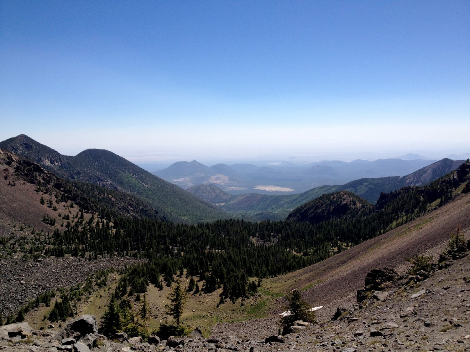
From this sign up to the saddle, the trail takes you up a steep, rocky, sandy section – perhaps one of the most difficult short stretches of the entire hike. Once you reach the saddle, you’ll know it. It’s a relatively flat section that separates Humphreys Peak from neighboring Agassiz Peak and offers up tremendous panoramic views to the east and west.

Note: Hikers and climbers are only allowed on Agassiz Peak when it is snow covered due to the existence of federally-protected plant life (Senecio Franciscanus) on the peak in warmer months.
From the saddle, which happens to be an excellent resting spot, the trail heads north into a steeper and rockier section. This final mile of the trail is filled with big boulders, narrow trails, ridge walking and a handful of false summits.
Beware the false summits!
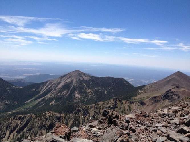
There are at least three points in the final mile where it seems that the summit is literally just around the corner when, of course, it is not. Keep heading north. The first time on this trail, the false summits can make this final one mile of hiking seem like three.
And if it happens to be a windy day (it was on this day) this is also the section of the trail where you’ll feel it the most. The ridges are exposed and the gusts pick up intensity as you get above 12,000 feet. After the final false summit, you’ll see the true summit up to your left. Battle the wind and scramble up the final hill of loose rock and boulders and the summit is yours.
Enjoy the views and take shelter behind one of the rock walls for a break from the wind.
Hike stats
Date of climb: June 2012
Route: Humphreys Peak Trail
Trail distance (estimate): 9.5 miles roundtrip
Elevation change (estimate): 3500 ft.
See also: Map & list of all U.S. State Highpoints
Photos from this trip